Mapping and Responding to Coastal Inundation

Introduction
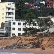
Given that it is impossible to stop climate change impacts and resultant sea level increases and more intense significant storm events, Local, State and Federal authorities are faced with the need to consider key areas at immediate to medium threat. This information needs to then be applied to planning mechanisms and management strategies to cope with future impacts of increased coastal inundation and erosion directly impacting existing, redeveloped and new development within their coastal landscape areas.
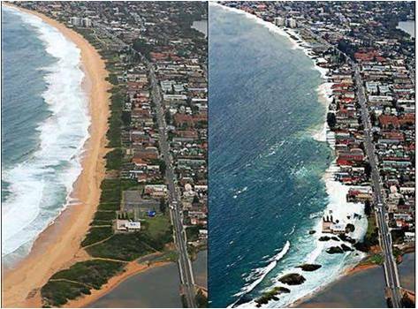
This project maps areas of risk, utilising sophisticated modeling together with Councils own information sources Inundation(eg LiDAR technology) to determine risk and develop consistent model planning and management responses in consultation with relevant state government agencies and the broader community.

In 2009 the SCCG secured grant funding under NDMP to undertake the project with the CSIRO entitled Mapping and Responding to Coastal Inundation

Aims and Objectives

  • Enhance the capacity and knowledge of local governments and other decision makers in the region to prepare for and adapt to climate change (specifically focusing on sea level rise and extreme water levels, eg storm surges),
  • Develop an approach to climate change assessment and adaptation with a particular focus on relevant planning provisions in identified immediate and future coastal inundation (flood) zones and potential beach erosion escarpments,
  • Develop and distribute associated community risk disclosure information and corresponding community and stakeholder education programs to better inform communities of the degree of risk(s).
Project Outputs

The SCCG engaged the Environmental Defender’s Office NSW (EDO) to conduct a comparative assessment of:

  1. Australian State and Territory planning and coastal legislation and policies that address sea level rise, coastal erosion, coastal inundation and storm surge; and
  2. regional and international jurisdictions.

The results of this analysis are presented in the report prepared by the EDO, a copy of which can be downloaded by clicking on the following link:


Audit of Sea Level Rise, Coastal Erosion and Inundation Legislation and Policy


For the Stage Outcome Reports, please click on the report titles below.
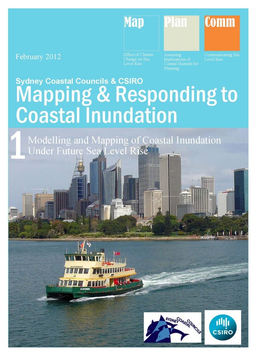

Stage 1: Effect of Climate Change on Sea level Rise and Extreme Sea Levels:

A set of high resolution hydrodynamic model simulations were produced in order to obtain current climate, as well as storm tide return level estimates and sea level rise considerations.
Stage 2: Development of model planning provisions to integrate sea level rise and extreme sea level events into relevant planning strategies of the SCCG:


  • Assess existing planning strategies (Australia and Internationally)
  • Identify gaps in information, knowledge, capacity or external barriers
  • Develop model provisions, actions and implementation strategies
Stage 3: Develop and distribute community risk disclosure information and corresponding community and stakeholder education program:


Assess existing education strategies within Australia and Internationally for addressing and communicating sea level rise and flooding impacts.

  • Consultation with member councils and targeted community groups and individuals to identify gaps in information, knowledge and capacity as well as internal and external barriers for message transfers.
  • Utilising outcomes of stage 1 and 2 and incorporating the above to develop and deliver freely available educational tools that build the understanding and capacity of relevant stakeholders.
PROJECT LAUNCH

Southern Function Room, Town Hall House, 4 October 2012.

This project was launched to assisted attendees to understand project outcomes and outputs to take back to their own organisations for use.

There was a Panel Discussion with the key speakers of the day. This allowed attendees to ask questions about the project outputs and the NSW 2012 Stage One Coastal Reforms.

The launch also involved the establishment of a secure and temporary FTP server to provide Member Council access to the project outputs including all mapping information, stage outcome reports and associated meta date information.

Click here for the Project Launch Report.

Click here for the NCCARF Climate Change Adaptation Good Practice Case Study of the SCCG Mapping and Responding to Coastal Inundation project.


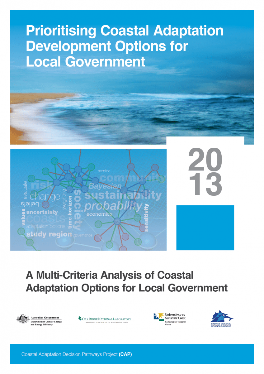
Prioritising Coastal Adaptation and Development Options for Local Government Project

Managing the risks posed by climate change to coastal communities is a challenge faced internationally. Sydney is particularly vulnerable, with more than 7,000 properties at risk from coastal hazards. While much of the literature relevant to coastal adaptation has focused on assessing the vulnerability of coastal communities, there is limited guidance for Local Government on the appraisal of specific adaptation options.

Prioritising Coastal Adaptation Development Options for Local Government addresses this need for guidance, via a participatory, multi-criteria analysis (MCA) of coastal adaptation options for Local Government.

The project is now complete and was launched on 27 March 2014 (see below for further details of the launch).

Download the Project Fact Sheet here.

Overview of the project

The project explores prioritisation of adaption options in response to coastal inundation and erosion. It brings together information on exposure and risk, feasible adaptation strategies and the multiple values that influence Local Government decision-making, including governance, economic, social and environmental. It also develops a broad range of criteria by which the performance of adaptation strategies can be evaluated.

The project provides a basis for future development of practical decision support tools. It involved the following key components:

  1. A Literature Review was undertaken to identify feasible adaptation responses to coastal inundation and erosion. The Review highlighted 15 options categorised under four categories – protection, accommodation, retreat and cross-cutting.
  2. Local Government staff across three case study regions (Bega Valley, Sunshine Coast and coastal Sydney) were surveyed for their views on these options. Multi-criteria analyses enabled assessment against multiple governance, economic, social and environmental criteria, across various time horizons.
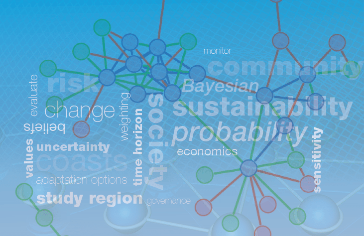
  3. A Bayesian Belief Network (BBN) was developed, enabling the integration of the survey results with spatially explicit information regarding coastal hazards and assets.
  4. A Geographic Information System (GIS) was used to display outputs from the BBN, so that information on hazards, assets, and the utility of different adaptation options could be visualised for any property in each of the three study regions.

In addition, a Guide to Monitoring and Evaluating Coastal Adaptation has been developed, to assist Local Government in tracking progress towards adaptation goals and identifying best practice adaptation. The Guide is currently being road-tested with five Councils (Bega Valley, Leichhardt, Rockdale, Sunshine Coast and Sutherland), to consider opportunities for improvement and additional support materials. Outcomes from this process will be available in the coming months.

Project Outputs

The key outputs from the project are:

Monitoring and Evaluating Coastal Adaptation

One of the findings to emerge from the project was that, although adaptation efforts are widespread in Local Government, there is limited evidence of appropriate monitoring and evaluation. When it comes to monitoring and evaluation, the focus is typically on measuring the outcomes of particular actions. However, outcomes are very much influenced by the planning processes behind those actions and the resources and capital (capacity) used to execute them. Without an understanding of the way these factors are influencing outcomes, it is hard to fully appreciate how effective or ineffective those actions are.

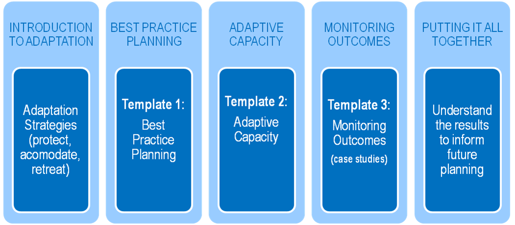
To address this issue we have developed A Guide to Monitoring and Evaluating Coastal Adaptation. The Guide provides a framework for monitoring and evaluating the climate change adaptation strategies and practices of Local Government in coastal areas, focusing on three key areas – best practice planning, adaptive capacity and monitoring outcomes.

Overview:

The Guide begins with a brief overview of different adaptation strategies, based on the ‘protect-accommodate-retreat’ framework. It then proceeds into more focused consideration of the three key areas of planning, capacity and outcomes, drawing on best practice principles and standards.

A series of templates and case studies take users through an evaluation of their own adaptation plans against these best practice principles and standards. The templates contained in the Guide present a number of best practice principles for adaptation planning, adaptive capacity and monitoring outcomes. They are intentionally pitched at a high level, so that they can be applied across a range of contexts.

Although the Guide is focused on climate change adaptation, the principles and tools contained therein can be applied to planning processes generally. Indeed, climate change adaptation cuts across all functional areas of Local Government and should ultimately be embedded in all planning processes.

Downloads:

A Guide to Monitoring and Evaluating Coastal Adaptation (2nd edition)

Editable versions of templates:

Background

The Guide is based on a literature review of relevant publications, as well as an online survey and workshops with the 15 Member Councils of the Sydney Coastal Councils Group, the Sunshine Coast Council, and Bega Valley Shire Council.

The original Guide, published in 2012, has been further refined based on outcomes from a Pilot Workshop Series with Council representatives from Bega Valley Shire Council, Leichhardt City Council, Rockdale City Council, Sunshine Coast Council and Sutherland Shire Council in early 2014.

Project Launch

On 27 March 2014, we launched the outcomes from the project. Fifty-two individuals attended the launch, representing 28 different organisations. The launch featured presentations from the principal researcher, Dr Ben Preston of Oak Ridge National Laboratory (USA), as well as the Coastal & Marine Unit of the NSW Office of Environment & Heritage and the SCCG. Presentations examined three key elements to coastal adaptation – exposure assessments, decision-making tools and monitoring & evaluation. This was followed by a panel discussion and workshop, which provided an opportunity for participants to explore issues further.

The Launch Outcomes Report provides an overview of the day’s proceedings and outcomes. Click here to download the report.

The following presentation slides are available for download:

Overview of SCCG Coastal Adaptation Pathway Project
Geoff Withycombe, Executive Officer, Sydney Coastal Councils Group

Prioritising Coastal Adaptation Options for Local Government: A Multi-Criteria Analysis for Local Government
Dr Ben Preston, Senior Research Scientist, Oak Ridge National Laboratory

Monitoring and Evaluation for Adaptation
Emma Norrie, Coastal Projects Officer, Sydney Coastal Councils Group

Coastal Vulnerability to Multiple Inundation Sources Project (COVERMAR)

A prize winning project!

This project received State and National recognition, winning both the New South Wales and Australian 2014 Resilience Australia Awards (local government category). The Awards recognise innovative practices and achievements across the nation which support and strengthen community disaster resilience.

Intoduction

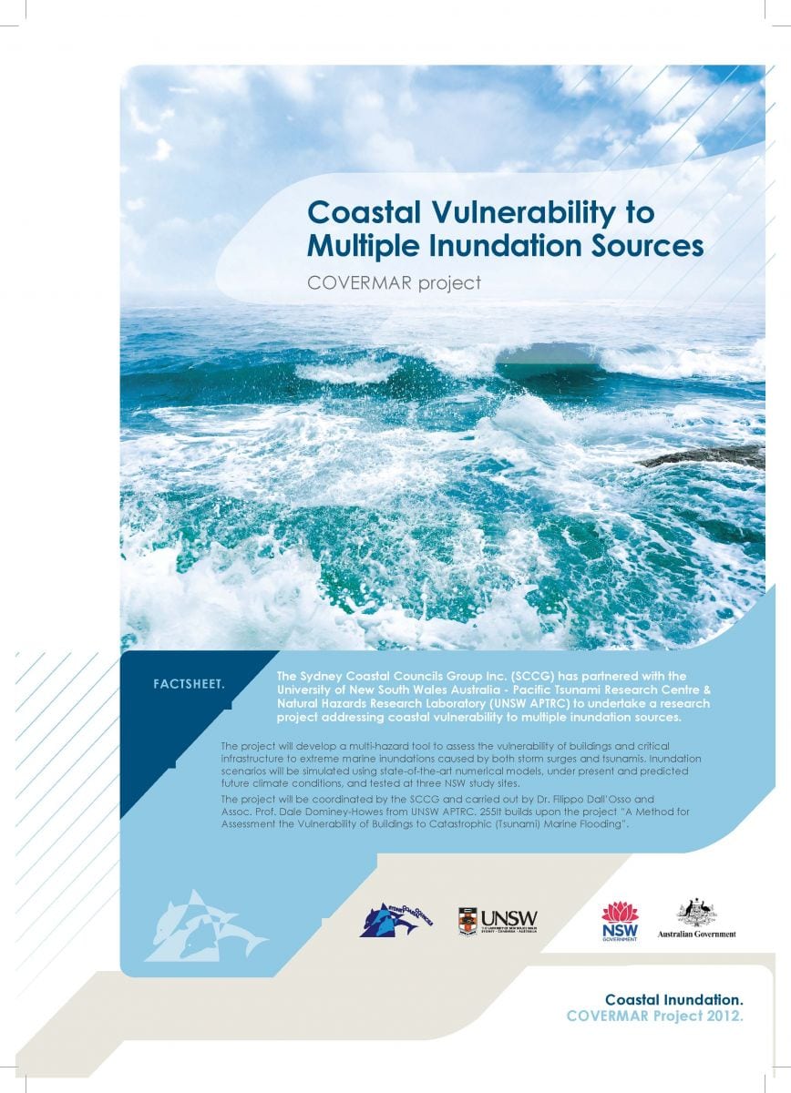
The Sydney Coastal Councils Group Inc. (SCCG) partnered with the University of New South Wales Australia – Pacific Tsunami Research Centre & Natural Hazards Research Laboratory (UNSW APTRC) to undertake a research project addressing coastal vulnerability to multiple inundation sources.

The project has developed a multi-hazard tool to assess the vulnerability of buildings and critical infrastructure to extreme marine inundations caused by both storm surges and tsunamis. Inundation scenarios were simulated using state-of-the-art numerical models, under present and predicted future climate conditions, and tested at three NSW study sites.

The project was coordinated by the SCCG and carried out by Dr. Filippo Dall’Osso and Assoc. Prof. Dale Dominey-Howes.

The project Fact Sheet can be viewed by clicking on the image below.

Stages

  1. We developed a multi-hazard tool to assess the vulnerability of buildings and critical infrastructure to extreme coastal inundation caused by storm surges and tsunamis, modelling 36 tsunami scenarios combining two sources, three annual tsunami probabilities, the current and two future sea levels and high tide and mean sea level.
  2. We undertook a multicriteria analysis of the vulnerability of our 15 Member Councils and identified Botany Bay and the adjoining Port Hacking and Bate Bay as an appropriate case study location.
  3. We surveyed the physical and engineering attributes of all buildings in the study area (~4000 buildings) and imported them into a GIS system.
  4. State of the art building fragility models were applied to assess the level of damage of each individual building
  5. We then calculated expected economic losses (Probable Maximum Loss) drawing upon current building construction, demolition and replacement costs. Results were displayed on a series of coded high-resolution colour coded maps.

Project deliverables inform coastal strategic planning, development assessment and emergency management. They expand awareness and understanding of the vulnerability of NSW coasts to inundation (from storm surge and tsunami) and its impact on infrastructure, canvassing recommendations in relation to planning and development and coastal and emergency management. Many elements of the project methodology can be applied to other hazards such as bushfire and flooding.

Funding

This project is funded by the Australian and NSW Governments and conducted under the Natural Disaster Resilience Program, as described in the National Partnership Agreement on Natural Disaster Resilience and the NSW Implementation Plan 10/11.

Project Outputs

Literature Review Report

A Literature Review Report has been prepared that provides contextual knowledge and information regarding the project. It reviews relevant past, existing and emerging work that has been synthesised into five sections:

    1. Scope
    2. Risk, hazard, vulnerability and exposure
    3. Extreme inundation events
    4. NSW policy framework on coastal and flood risk
    5. Review of methods for assessing the vulnerability of buildings and infrastructure to extreme inundations.

The Hazard Assessment Report reviews the numerical simulations of the selected tsunami and storm surge inundation scenarios: 1/100 yr storm surges, and 1/100 yr, 1/1,000 yr and 1/10,000 yr. tsunamis under present and future sea level conditions.

Outcomes Report

This report describes the methodology and presents the results of the building and infrastructure vulnerability assessment at a NSW case study location.

Project Launch

On 17 February 2014, at Customs House, Sydney, the project deliverables were launched. Presentations from the principle researcher and three other industry stakeholders (Geoscience Australia, NSW SES and the Hazards Research Group, University of Sydney) were delivered to 62 attendees representing 40 different organisations. Presentations provided an overview of storm surge and tsunami risk in Australia, reflected on the role of the NSW State Emergency Service and the contribution to research and information by Geoscience Australia. It also reviewed the development of the tool, project methodology, benefits afforded by the Advisory Committee, case study locations and the results thereof. An end-of-launch panel discussion provided an opportunity for participants to explore issues further.

Overall, 80% of respondents considered the event very good or excellent, and very or extremely unique. Ninety-two percent thought it was well structured and 50% said it exceeded expectations. Notably, 92% indicated that their skills and knowledge of coastal hazards such as storm surges and tsunamis improved by attending the event. Presenters were well prepared (100% agreement) and communicated well (90% agreement). It was also a good networking opportunity (87% agreement).

The subject matter, structure, duration, high calibre of presenters and the contribution of participants ensured that the event was a success. Lessons learned and evaluation results will be applied to future activities to ensure continuous improvement of SCCG events.


The following presentation slides from the Launch are available for download:

Associate Professor Dale Dominey-Howes, University of Sydney

Australian Tsunami – An overview from hazard to community risk perception.

Dr. Filippo Dall’Osso, UNSW
Coastal vulnerability to multiple inundation sources

Belinda Davies, NSW SES
Emergency management of coastal hazards in NSW

Mark Edwards, Geoscience Australia
Natural hazards impact accessment at Geoscience Australia