Sydney Institute of Marine Science

The Sydney Institute of Marine Science and the Sydney Coastal Councils Group adopted a Memorandum of Understanding in October 2020.

The MOU will establish a framework for the parties to work collaboratively on activities that will assist in the achievement of both organisation’s vision and goals.

SCCG’s Council Members and SIMS have responsibilities that can be mutually beneficial for both organisations. Collaboration is desirable to assist with responding to current and future opportunities and threats of our coastal and estuarine environmetns.  Collaboration will also avoid duplication of efforts, promote efficient use of resources and regional integration of management.

Specifically, SIMS provides SCCG with an opportunity to strengthen its research capacities and ensure the latest research information informs Council Members planning and management decisions. SCCG provides an opportunity for SIMS staff to collaborate more closely with Council members, build their capacity, and rollout SIMS actively more efficiently and at a regional scale.

Click here to see the final MoU.

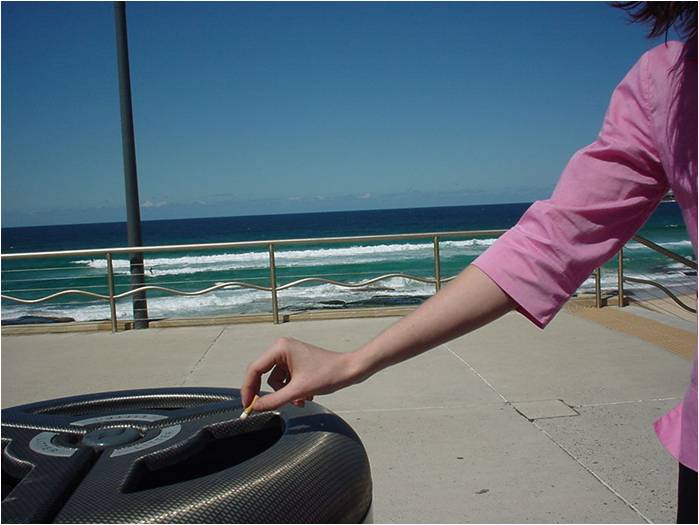
Preventing Cigarette Butt Littering: A Resource Package for Local Government

Introduction

The SCCG has prepared a resource package to assist Councils and other interested stakeholders to encourage the correct disposal of cigarette butts.

Aim and Objectives

The Preventing Cigarette Butt Litter in the Sydney Coastal Region project purpose was to provide Member Councils, other authorities and the community with a range of best practice tools and information that they can implement to address cigarette butt littering in their local area.

Outcomes / Outputs

The principle outcome of the project is an innovative resource package that provides Councils and in turn the community with information on the extent and problems of cigarette butt littering, legislation, enforcement ideas, bins and devices available and a range of example education initiatives. Secondary outcomes have been greater community awareness of the effects of cigarette butt littering and a reduction in cigarette butt litter.

Contents of the Resource Package:

  • Introduction (Concept and how to use the package)
  • Facts and Figures (Extent of littering and effect of the pollution).Bins and Devices (Example bins and devices to assist correct disposal).
  • Legislation (Relevant to littering and smoking area restrictions).
  • Enforcement (Licensing, PINs, MOUs, property leases, standard conditions for development).
  • Education (Education projects, activities, media releases, posters, stickers).
  • Relevant Contacts and Internet Site Details.

For a hard copy of the Resource Package or for more information please contact SCCG.

Coastal Connections – SCCG Community Engagement Strategy (Social Media)

Introduction

In 2010 the SCCG was successful in obtaining a small grant from the Sydney Metropolitan Catchment Management Authority (SMCMA) to deliver the SCCG Coastal Connections Project. The funding is from the ‘Engaging NSW Communities in Coastline Conservation’ cross regional project involving the five coastal CMA regions in NSW and part of the Commonwealth Government’s ‘Caring For Our Country’ program.

Aims and Objectives

The aim of the SCCG Coastal Connections Project was to engage the next generation of conservation volunteers and to increase awareness and participation in coastal management and conservation activities. In addition to conducting ‘on-ground’ works the SCCG thought it would be interesting to investigate how to engage the community using new and modern mediums such as cutting-edge social marketing and social media channels.

The SCCG Coastal Connections Project was made up of four main components:

  1. To create and trial a Community Engagement Strategy that focuses on using social media to target the next generation to become involved in coastal conservation.
  2. To deliver capacity building tools and workshops that inform SCCG Member Councils and other stakeholders about new ways to engage the community, focusing on social media.
  3. To trial using a social media strategy to conduct a social media campaign to increase the awareness and participation of the SCCG Summerama: Summer Activities Program activities.
  4. To deliver in partnership with project partners three bush regeneration / conservation events held in the iconic locations of Kurnell, Narrabeen Lagoon catchment and North Head during January 2011, as part of Summerama: Summer Activities Program.
Outcomes / Outputs

The outcomes of the project are defined as:

  • Raising awareness of community conservation activities, with the anticipation of increasing participation and diversifying the community members that take part in coastal conservation.
  • Building the capacity of the SCCG Member Councils and other stakeholders to consider different / modern approaches to engaging their communities.
SCCG Community Engagement Strategy (Social Media)

The production of the SCCG Community Engagement Strategy (Social Media) was to provide a capacity building tool that Member Councils and other stakeholders could use either as a step by step guide or as an inspirational tool to help think about ideas and consider trying when using social media to engage the community.

The Strategy includes background information on the SCCG Coastal Connections Project; information about the SCCG Summer Activities Program (SAP) that was used as a case study to trial the social media strategy; the project phases of developing a new brand and image for SAP – becoming Summerama: Summer Activities Program; the Social Media Strategy used for Summerama; a “Quick Guide to Social Media” (that was developed for the social media workshop provided as part of the Coastal Connections Project); the Social Media campaign results; and finishing with comments from the Project Manager about lessons learnt and the success of the project.

The SCCG Coastal Connections Project is considered unique because it has explored access to other networks not commonly associated with natural resource management by using social media.

SCCG Community Engagement Strategy (Social Media)


Funding Project Partner / Consultant

Bush Regeneration Event Partners

Walking Coastal Sydney

Introduction

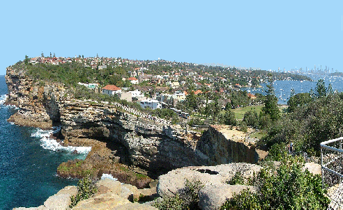
Sydney’s coastline represents one of the most beautiful and environmentally diverse attractions in the world. It features cliffs, beaches and inlets of magnificent beauty unique to the region. Outlined in the brochures produced through the Walking Coastal Sydney project is a continuous walking track that residents and visitors can utilise to explore the beautiful coastline of Sydney.
Aim and Objectives

The aim of the Walking Coastal Sydney project is to promote public access to, and enhance the appreciation and recreational enjoyment of Sydney’s coastline and estuaries for the people of Sydney and visitors to the city. Walking Coastal Sydney was a partnership project between the Sydney Coastal Councils Group, the Walking Volunteers Inc. and Department of Planning, with funding received through the Sharing Sydney Harbour Access Program.

Through the project a series of brochures/walking maps that combine to provide a mapped and walkable route from Pittwater in the north to Sutherland in the south and linking with existing coastal walks have been produced.


Downloadable Maps

Updated Walking Maps are available to download at this link.

Note: this link can also be used to download the maps to your smart phone or tablet.

For Android phone to navigate, please follow instructions below:

  1. Once you have clicked on above link.
  2. Click on Google Maps app
  3. Tap Menu > Your Places > Maps
  4. Tap the map “Walking Coastal Sydney” which should now be on the Maps menu

For detailed instructions on how to download and/or print maps, click here.

Walks – Brochures/Maps

Brochures for the mapped walks as part of Walking Coastal Sydney are provided below.

This brochure covers the coastal route from Barrenjoey Headland at Palm Beach to Narrabeen Lakes on Sydney’s Northern Beaches. At its northern end, it is a starting or terminal point for the network of walks, while at its southern end it connects with the Narrabeen Lakes to Manly Lagoon walk.

This walk begins with the coastal and Pittwater panorama from historic Barrenjoey Lighthouse, passes through Palm and Whale Beaches following a series of rugged natural headlands with extensive views interspersed with sweeping and secluded beaches, before reaching coastal dunes and wetlands feeding into Narrabeen Lagoon.

This brochure covers the route from Narrabeen Lakes to Manly Lagoon on Sydney’s Northern Beaches. At its northern end it connects with the Barrenjoey to Narrabeen Lakes walk; while its southern end links with the Manly Lagoon to North Head and the Spit walk.

This is a splendid coastal walk featuring long, sweeping beaches, separated by several headlands with extensive views, including Long Reef Point with its aquatic reserve. The entrances of four lagoons with their wetland areas are also crossed.

This magnificent walk features the famous Manly Beach, Shelly Beach, Sydney Harbour National Park, the former School of Artillery, North Head Sanctuary, and North Head which dominates the entrance to Sydney Harbour and offers extraordinary views down-harbour. It passes the former Quarantine station and Manly Cove before returning to Manly wharf to set out on the popular Manly Scenic Walkway.

This iconic walk circles North Harbour before climbing though the outstanding scenery of another section of Sydney Harbour National Park which overlooks the Heads, Crater Cove and Grotto Point Light. It then drops into popular Clontarf Beach and a final bush track to the Spit bridge. At its northern end the walk connects with the Narrabeen Lakes to Manly Lagoon walk while its western end links to, and partly duplicates, the Harbour Bridge to Manly via Spit walk.

This brochure covers walking routes from Sydney Harbour Bridge via the Spit Bridge and on to Manly. At its southern end it connects with the Harbour Circle and Harbour to South Head and Clovelly walk. Its northerly section links and partly duplicates the Manly Lagoon to North Head and the Spit walk.

This brochure covers walking routes from Sydney Harbour Bridge via South Head and on to Clovelly. At the Harbour Bridge it connects with the Harbour Circle Walk and Harbour Bridge to Manly via Spit walk; while at its southern end it connects with the Clovelly to Cronulla walk.

The main route covers the southern shores of Sydney Harbour through scenic waterside parkland and urban landscapes resonating with history and interesting architecture. At charming Watsons Bay it meets the dramatic entrance to Sydney Harbour. It then swings south past the notorious Gap and 80m ocean cliffs before dropping down to iconic Bondi Beach and the succession of eastern beaches to Clovelly. Sites of interest along the way include Macquarie Lighthouse, two historic cemeteries, waterfront parkland, interesting architecture and continuously wonderful scenery.

This brochure covers walking routes from Clovelly to Cronulla. At Clovelly it connects with the Harbour Bridge to South Head and Clovelly walk. Its southern end is the termination of this walking network but connects, via the Bundeena Ferry, with the coastal walk south through Royal National Park. Part of the link walk around the north western side of Botany Bay is covered by the Cook Park Trail.

The main route generally follows the route of the Federation Track along Sydney’s Eastern Beaches to La Perouse on Botany Bay. Beaches and cliffs, National Park, golf courses, historic military and other sites, a shipwreck, museums, a historic cemetery, important Aboriginal sites and land especially at historic La Perouse, characterise this northern part of the walk.

From Kurnell, at Cook’s Landing Place, the route passes through more of Botany Bay National Park with cliffs and wide ocean views, delightful coast flora, sandhills and Cape Baily Lighthouse, before leaving the National Park at Boat Harbour to follow the long sandhill-backed Wanda and Cronulla Beaches to Cronulla itself.

At present, there is no permanent ferry link between La Perouse and Kurnell. A long walk around Botany Bay is possible, and the Cook Park Trail is one attractive section, but much of the remainder is best done at the moment via public transport.

* Please note – this map does not reflect recent changes made to the walking route between Little Bay and La Perouse due to the opening of Malabar Headlands National Park.

This brochure covers a walking route circling Sydney Harbour with the Sydney Harbour and Gladesville Bridges as its eastern and western points. At the Harbour Bridge it connects with the Harbour Bridge to South Head and Clovelly and Harbour Bridge to Manly via Spit walks; at its southernmost point it connects with the Gladesville Bridge to Ryde Bridge walk.

The main route is a 60km, four-day walk, but it can easily be broken up into many short walks. Observatory Hill near the Harbour Bridge displays the circle’s westward vista of bays and waterways. Big bridges feature strongly, with seven major crossings. Highlights include north shore bays and bushland; urban and historic architecture, recycled industrial landscapes, former Callan Park asylum, Darling Harbour and the cottages and pubs of Millers Point. The northern and southern halves are roughly equal in length with the north often on undulating park and bush tracks, while the south tends toward flatter streets or parks.

This brochure covers walking routes between two bridges on both sides of the Parramatta River, and traverses a number of significant bays, parks and historic sites, and includes the magnificent Concord Foreshore Trail between Majors Bay and Brays Bay and the moving Kokoda Track Memorial.

Other features of interest include the former Walker Family estate buildings Yaralla and Rivendell, historic Gladesville Hospital, Sydney’s last car ferry Mortlake to Putney , several former industrial sites, waterfront parkland, and a historic rail bridge now converted for bike and pedestrian use. At its eastern end the brochure connects with the Harbour Circle Walk while its western end links with the Parramatta River Walk – Ryde Bridge to Parramatta.

This brochure covers walking routes along the western section of the Parramatta River. At its eastern end it connects with the Parramatta River Walk- Gladesville Bridge to Ryde Bridge. Its western end  is the terminal point for this series of walks.

The route includes a fascinating walk through the picnic grounds and mangrove walkways of Bicentennial Park; edges the remarkable recovered landscape and built environment of Sydney Olympic Park, including its extraordinary Brickpit Ring. The walk crosses the river twice as it continues along the riverbank of the Parramatta river through Parramatta CBD before entering the world heritage listed Parramatta Park. A track opened in 2011 leads to the western end of this walking network and the historic camp site at the head of the River reached by Governor Arthur Phillip in April 1788.

* Hard copy walking maps are no longer available.

Summerama: Summer Activities Program

Summerama is a community activities program run every year during January, designed to enhance community awareness and increase the community’s interaction and connection with Sydney’s coast through fun, family orientated coastal activities.

http://www.sydneycoastalcouncils.com.au/summerama/

Underwater Sydney

Underwater Sydney

This website brings Sydney’s underwater world alive providing images and information on the marine species that live in Sydney. Go to the website and search for your local government area.

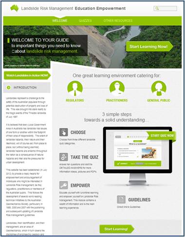
Landslide Risk Management Education Empowerment Interactive Website

Landslides represent a challenge to the safety of the Australian community through potential destruction of property and loss of life. This was brought into stark reality by the tragic events of the Thredbo landslide of July 1997.

It is believed that every Local Government Area in Australia has landslide risk issues of one form or another. The extent of landslide hazards, their nature and their likelihood, will of course vary from place to place.

This website launched late 2012 has been developed by Australian Geomechanics Society (AGS) in an on-going partnership with the Sydney Coastal Councils Group, provides a ready means for empowerment and encouragement of individuals who might be interested in Landslide Risk Management, be they regulators, practitioners or members of the general public.

It follows on from the very success 2007 SCCG and AGS project which developed AGS 2007 including:

  • Landslide Risk Management – Practice Note
  • Landslide Hazard Zoning – Guideline
  • Landslide Slope Management and Maintenance – Guideline

The interactive web site provides the user a broad range of information around landslide risk management. The web site provides:

  • An interactive quiz by way of introduction for each of the areas of interest: regulator; practitioner; and general public;
  • Videos of landslides in action from around the world;
  • Direct links to the AGS (2007) Landslide Risk Management Guidelines, as published in Australian Geomechanics, http://lrm.australiangeomechanics.org/other-resources/guidelines/ags-2007/
  • Video coverage of the Landslide Risk Management “Risky Roadshow” seminars held throughout the nation in the first half of 2011, presenting important features from AGS (2007) to both regulators and practitioners;
  • Answers to frequently asked questions; and
  • Links to other important landslide related web-sites.

This great resource will:

  • Assist your Learning
  • Assess your knowledge and understanding of landslide risk management
  • Increase your knowledge of useful landslide management tools &
  • Expand, support, advance and validate your knowledge for professional or personal needs

This project was made possible with supporting funding from the Australian and NSW Governments under the National Disaster Mitigation Program (NDMP).

Becoming Social – SCCG’s Social Media Project

Introduction

Social media has changed the way we work, rest and socialise, but when and how do we harness it to increase community engagement, participation and awareness of environmental matters? And what happens if it generates negative commentary?

Under the Local Government Act 1993, Councils are obliged to properly manage, develop, protect, restore, enhance and conserve the environment. This function cannot be achieved without community engagement, participation and awareness of environmental issues, policy and programs.

The growth in social media has meant that many traditional communication and engagement activities are outdated, poorly targeted or irrelevant. Effective social media frameworks and strategies can reach out to and connect with an evolving audience and promote an interactive discourse, triggering insights into how existing government programs and policies can be implemented, supported and developed. However, knowledge gaps remain as to what platform to use and when. There is also hesitation in the uptake of new technologies due, in part, to a perceived loss in control of content and a fear of negative commentary.

Funding

We were awarded a NSW Environmental Trust grant to increase understanding of the social media ‘space’.

Outcomes

The Becoming Social project is designed to increase Councils’ understanding and use of social media as a relationship and policy development tool to engage, consult and educate coastal communities in relation to local and regional coastal environmental issues.

The project has three 3 key outputs:

  1. A survey among SCCG Member Councils exploring application, adoption and use of social media, and, in particular its use to address environmental issues.
  2. Literature Review and Report investigating, summarising and synthesising social media and its use in Government engagement, consultation, education and policy development.
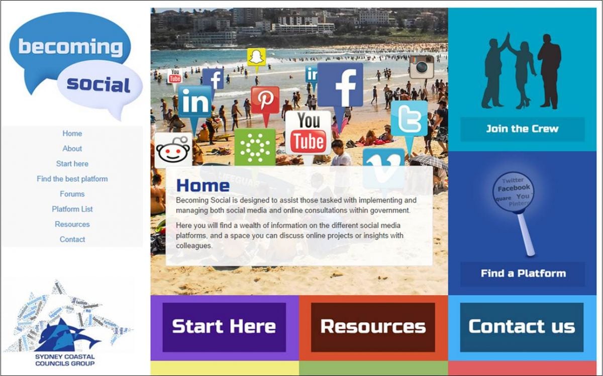
  3. An innovative online tool (and associated resources) to enable Councils to use social media as a relationship, project and policy development tool. Please click on the image below to access the tool.

Developments

The Project was guided and informed by a Steering Committee comprised of social media, environment, Local Government and other specialists.

Stage 1

A stakeholder survey among our 15 Member Councils has been conducted by a consultant with relevant expertise, to explore Councils’ current understanding and use of social media. The survey explores the application, adoption and use of social media in Local Government, and in particular its use to address environmental issues. Specifically, results identify current social media strategies, policies and tools employed as well as any gaps, barriers and capacity required.

Stage 2

Another consultant, expert in the field, was retained to undertake a literature review to underpin project outputs. The review investigated, summarised and synthesised social media and its use in Government engagement, consultation, education and policy development.

Stage 3

A specialist social media consultancy providing social media advice, strategy, training, content, analysis, and risk management solutions was commissioned to develop an innovative online tool (and associated resources) to enable Councils and agencies to use social media as a relationship, project and policy development tool which integrates with traditional engagement, consultation and education methods addressing local and regional coastal environmental issues.

Project outcomes launch

On 24 July 2014 at Customs House, Sydney, we launched the key project deliverables and outcomes. Presentations were delivered (by the project consultants, our project manager and our Member Willoughby Council) to 41 participants representing 19 different organisations. The presentations contextualised the project providing an overview of social media, especially in local government, and addressed gaps, needs and opportunities. The suite of resources developed through the project was reviewed in detail to provide participants with the understanding and familiarity to access and use them immediately. This was complemented by the presentation from Willoughby Council, which provided an ‘on-ground’ practitioner’s perspective and insight. An end-of-launch panel discussion then afforded participants the opportunity to explore issues further and have presenters address any queries or questions that emerged during their presentation.

A key output from the project was the Becoming Social website. This purpose-built website supports the suite of project deliverables, which include:

  1. The Becoming Social web-based decision tool and associated resources
  2. The Becoming Social online community platform
  3. Guides to implementing a social media initiative, including strategy development, monitoring and evaluation
  4. A survey report on the use of social media in Local Government
  5. A literature review report on social media and its use in Government engagement, consultation, education and policy development.

The subject matter, structure, duration, high calibre of presenters and the contribution of participants ensured that the event was a success. This was reflected in participant feedback, with 95 per cent rating it good or excellent. Lessons learned and evaluation results will be applied to future activities to ensure continuous improvement of SCCG events.

For a copy of the Project Launch Outcomes Report, please click HERE.